
5 Easy Ways to Upload a Spreadsheet and Turn It Into a Map
Have a spreadsheet full of addresses, customer data, or sales locations you want to visualise on a map? Good news: it's easier than you think.
You don't need GIS software, coding skills, or even a complex setup.
You need Mapstack. We’ll compare it against four other systems and explain why it’s the best way to upload spreadsheet data and easily create, edit and share an interactive map for your website.
Whether you're working with Excel files, CSV exports or Google Sheets, Mapstack is a solution that will work for you.
The benefits of interactive maps
Interactive maps created using data from spreadsheets can be used in two ways:
- Externally, to engage customers
- Internally, to inform your staff
Customised, interactive maps embedded into web pages can help local customers using Google Earth or Google Maps find out important information about your business.
Internal interactive maps are not accessible to the public, and provide a wide range of information about your business.
Depending on the complexity of the map, it can include everything from location information and facilities available at your premises, to sales and marketing data.
Interactive maps can be customised to reflect your branding or theme, and have virtually no size limitations. There are other enhancements too. For example:
- Customise reference points
- Include videos, images or other data about your local area
- Display or hide details, depending on customer interest
Whether you want to increase customer engagement or give your team more insights, a quick and cost-effective solution is to create a map.
Ways to create an interactive map
There are lots of tools available for businesses to create their own interactive maps, but not all of them are made equal.
Here are five tools that can turn your spreadsheet data into a useful interactive map.
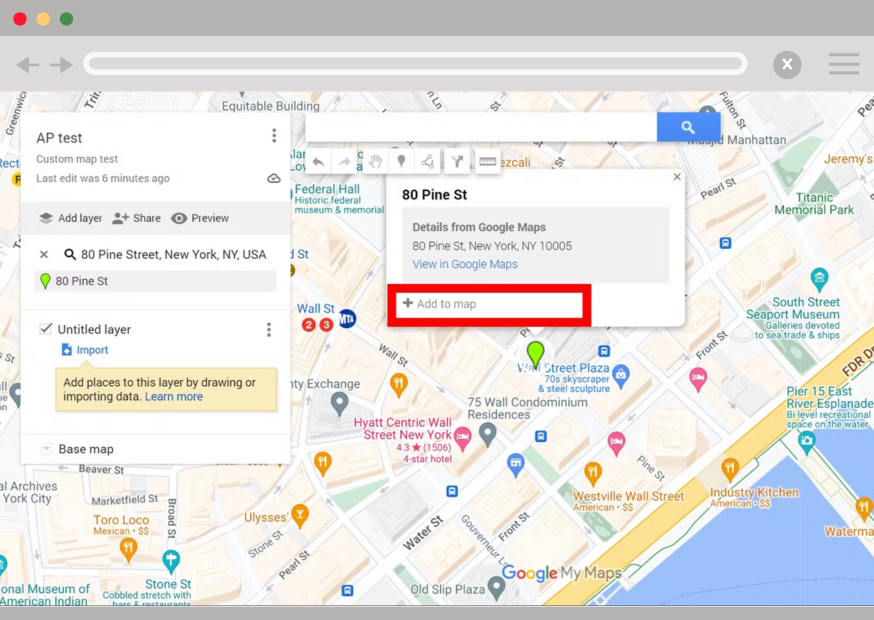
1. Use Google My Maps (Free but Manual)
Google My Maps lets you upload a CSV or Excel spreadsheet and plot points manually.
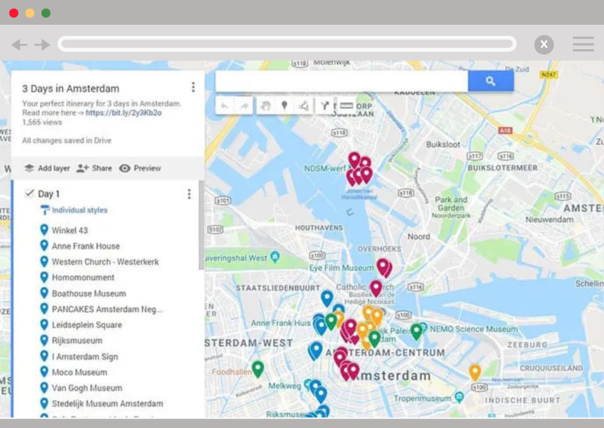
How it works:
- Go to Google My Maps
- Create a new map
- Click "Import" and upload your spreadsheet
- Choose columns for addresses or coordinates
- Style your pins if needed
Pros:
- Free
- Integrated with Google Drive
Cons:
- Manual matching of address fields
- Limited design and interactivity
- Best suited for basic maps
2. Try EasyMapMaker (Quick but Basic)
EasyMapMaker lets you drag and drop a spreadsheet to create a simple map.
How it works:
- Go to EasyMapMaker
- Upload your CSV file
- Select location columns (Address, City, Postcode, etc.)
- Customise map options and generate your map
Pros:
- Fast upload
- Simple setup
Cons:
- Limited customisation and sharing options
- Basic map styling
3. Use Atlist (Stylish but Copy-Paste Only)
Atlist offers beautifully designed maps but doesn't support file uploads directly.
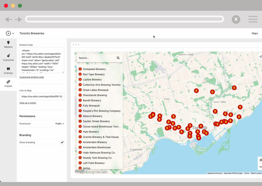
How it works:
- Go to Atlist
- Create a map
- Copy and paste your data from Google Sheets or Excel
- Assign fields to columns manually
Pros:
- Polished map designs
- Good for portfolios or presentations
Cons:
- No direct spreadsheet upload
- Manual setup needed
4. DIY with Google Sheets + Google Maps (Not Recommended)
You can manually input addresses into Google Sheets and use them inside Google Maps.
How it works:
- Prepare addresses in Google Sheets
- Open Google Maps and create a list
- Add pins manually, one by one
Pros:
- Free
Cons:
- Extremely time-consuming
- No automatic updates
- Not practical for more than a few locations
5. Bonus: Map Your Data Instantly with Mapstack
If you're looking for the most user-friendly option with a range of handy features, it has to be Mapstack.
You can upload a data file, import data as a spreadsheet (Excel, CSV, Google Sheets etc), and Mapstack will handle the rest.
It automatically finds multiple locations, for example addresses, regions, and patterns — no coding or GIS skills required.
Among Mapstack’s features is the ability to automatically highlight what matters: clusters, hotspots, and groupings.
With one click, you can overlay additional information, for example demographic data sets, regions, or other locations or points of interest.
You can then share your map with your team, embed it in a site, export an infographic or download it and keep it for internal use. You can edit your interactive map at any time.
How Mapstack works
Visit Mapstack.io
- Upload your Excel, CSV, or Google Sheets file from your computer
- Mapstack automatically detects location data and creates an interactive map
- Style, filter, and share your map in moments
Pros:
- Direct upload support for Excel, CSV, and Google Sheets
- No coding or GIS experience needed
- Create beautiful interactive maps quickly and easily
- Lots of different visualisation options available
Cons:
- None to date.
Video: Upload a Spreadsheet to a Map
Upload spreadsheet to a map
FAQs
Do I need latitude and longitude coordinates?
No! All the options listed here, including Mapstack, can geocode based on standard address fields (street, city, postcode).
What file formats can I upload?
You can upload:
.csv(Comma-Separated Values).xlsx(Excel files)- Google Sheets (by exporting as
.csvor connecting directly)
Can I edit or update my map later?
Yes, with tools like Google My Maps, EasyMapMaker, and Mapstack, you can add, edit, or remove locations after uploading.
Can I share or embed the map?
Most tools offer easy sharing links or embed codes to put your map on a website.
Conclusion
There are plenty of ways to transform your spreadsheet into a map. For quick and basic needs, Google My Maps or EasyMapMaker work well. For more flexibility and a modern experience, Mapstack offers an instant, upload-driven solution.
Explore the method that best fits your project and start mapping today.

If you're ready to create your first map in minutes, try Mapstack today!